EMLID FLOWMobile app
for land survey
Comes with a cloud-based service for keeping your data in sync.
Get startedLooking for the ReachView 3 app?
It is Emlid Flow now
All existing installations will update automatically. Upgrade to the Survey subscription to unlock new features or keep working as before with the forever Free version.
Free 
Efficient data collection and stakeout
Point collection
Collect points, write detailed descriptions, and perform quality control using our responsive interface. The app has built-in support for projections, grids, and geoids and a library with hundreds of verified coordinate systems.
Coordinate systems wizard
Intuitive stakeout tool

Linework
Collect data and create linework on the go
Measure and move ahead with just a few taps. You can use either predefined geometry types or a full-blown code library, whatever suits your needs.
Line stakeout
Navigating to a line is intuitive. With our visual guides, you can perform stakeout with an offset. The distance along the line indication will help you stake out with chainage.
Add codes to your data
Forget about memorizing code lists. Your whole library is always at your fingertips
Add codes, quickly switch between different object codes, start new lines, and continue collecting existing ones. Upload your custom code library or use a standard one built into Emlid Flow with more than a hundred codes available from the start.
Add codes on the go
No survey library is perfect, so you can always create new codes on the go
right in your survey project.
Work with different background maps
Upload topographic maps, cadastral plans, and aerial imagery from WMS and WMTS sources or work with a built-in satellite map.
Localization
Adjust your coordinate system to fit the control points
Find or adjust missing or outdated local coordinate system parameters. Depending on the data provided, Emlid Flow automatically chooses the calibration algorithm that delivers the best accuracy.
All residuals are placed on a single screen, so you have the full context while you adjust.
User reviews
 James LampingCalifornia, USA
Emlid has redesigned the app ReachView 3 so that it is no longer a web app, but a fully native iOS or Android app. This means that you can view and export your survey points from your phone even after you disconnect from your receiver! Another really great feature that was added is the ability to choose your coordinate system and vertical datum!
 Rory GilliesScotland, UK
We had a job observing control points for an aerial survey. It went great, surveyed straight to ETRS89 with Lerwick height. It was close to gale force winds but surveying with the RS2 is fun in any weather!
“Just started using the emlid 3.0 app. It’s really really good. Nice work!”

Carl PreusserFounder & CEO
at New Septic
“Emlid has developed an upgraded app ReachView 3. It's easy to use. It has all you need for survey/mapping. Datum, projection, and geoid.”
Ahmad FirdausSurveyor
at Jalal Johari Consultants Sdn Bhd
“I just installed the new
ReachView 3 app.
It is great!”

Dr. Hector R. HinojosaPrincipal Geoscientist
at Cordillera Geo-Services
“I currently use my iPhone with the ReachView app, and it works great.”

Rob CamirandPresident
of RC Drone Services
“It works brilliantly. I tested all the EPSG codes I need nationally, and it also allows to download a 2mb height set with a custom vertical EPSG. I use NTRIP and get a fix immediately. I switched completely from our other gear, as this is much faster. I can actually argue that I spend less than half the time surveying now.”

Aleksander JohansenTechnology Innovation Manager
at Digital Capital
Free Emlid Flow is the single app you’ll need in the field
Configure and control Reach receivers
Monitor your Reach receivers
All the necessary status information is available at your fingertips: satellite reception, solution status, modem reception, corrections stream state, and battery charge level.
Configure your base and rover
Manage NTRIP profiles
Raw data logging
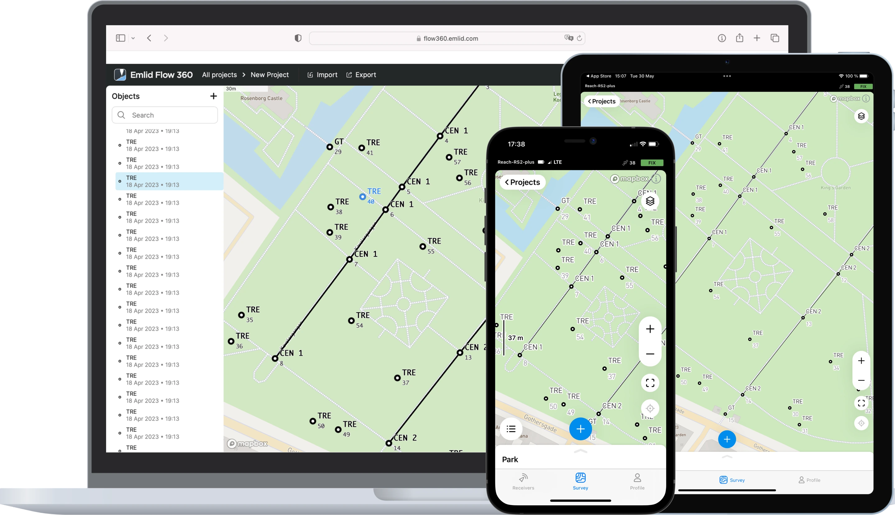
Free Create projects in the office
with cloud-based Emlid Flow 360 Collect data in the field with your smartphone using Emlid Flow
Emlid Flow handles all the fieldwork: data collection, coding, linework, and staking; while keeping your data in sync with Emlid Flow 360. Access your projects from the browser, manage code lists, WMS layers, and coordinate systems.
Forget about manually transferring files from controllers—Emlid Flow works offline and synchronizes data to Emlid Flow 360 as soon as your phone is back online.
Free
Sync your data and use up to 3 survey devices
Discharged smartphone isn't a problem anymore. You can use any device with Emlid Flow!
Just log into your account and get all your projects, NTRIP profiles, and custom coordinate systems from the сloud. Your Survey subscription is also linked to your account. No additional actions are needed.
Choose your version
Free
For simple projects requiring points only or post-processing.
Emlid Flow
- Collect and stakeout points
- Coordinate systems, geoids, and grid shifts
- Base shift
- Export and import in CSV, DXF, and SHP
- Built-in NTRIP client
- Full control of Reach receivers
Emlid Flow 360
- Project management and auto sync
- Export and import of survey data
Survey
For advanced surveying. All the benefits of Free version are included.
A single subscription for Emlid Flow and Emlid Flow 360.
Emlid Flow
- Collect and stakeout lines
- Add survey codes on the go
- Use WMS/WMTS layers
- Satellite map
- Localization
Emlid Flow 360
- Upload code libraries
- Satellite map
- Use WMS/WMTS layers