• Labrosse Consulting Logo
(705) 618-6225
EMAIL NOW
Google
 
Email now (705) 618-6225 Google
  • Home
  • Shop
    • EMLID Products
    • Vanavara Digital
    • TRIANGL GROUP
    • handheld
    • E38 Survey Solutions
    • MicroSurvey
    • DJI Enterprise
    • METTA
    • E-SURVEY
    • Alpha Geo
    • Quantum Systems
  • Sales
  • Services
  • About Us
  • Safety Information
  • TEOKIT Info
  • Testimonials
  • BLOG
  • Contact

TEOKIT Information

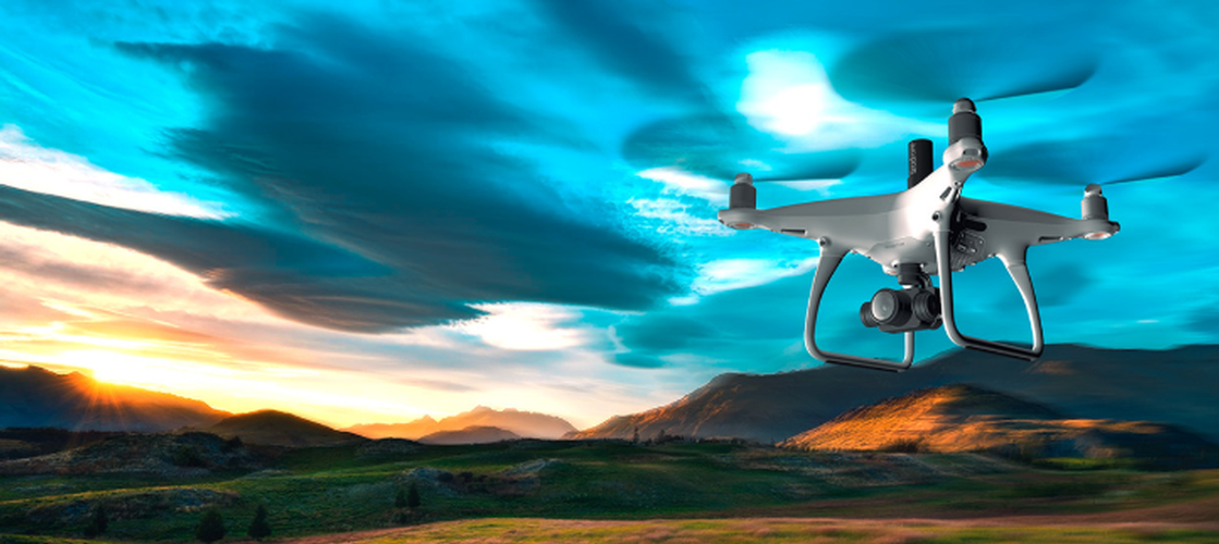
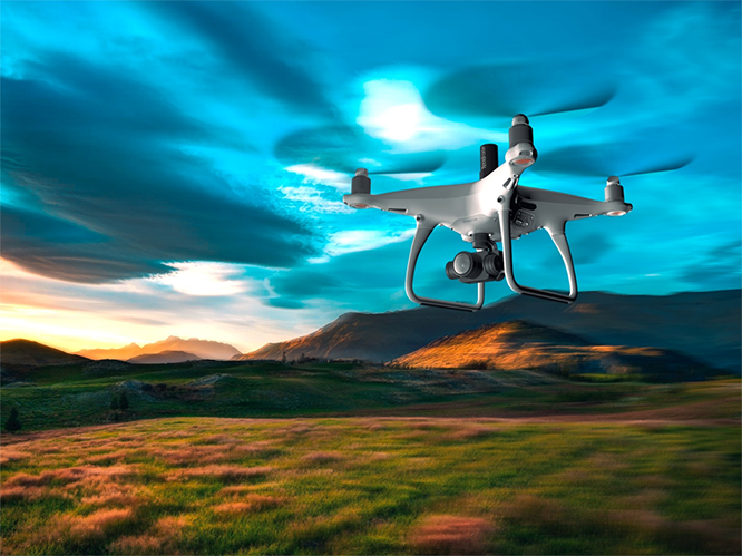
TeoKit is a leading provider of cutting-edge surveying equipment in Canada. Our advanced technology includes the DJI Phantom 4 TEO, the best solution for surveying using UAVs based on a GNSS board L1/ L2. This top-of-the-line quadcopter is designed specifically for geodesic surveying, and features a range of innovative technologies that make it the best topodrone on the market.

The DJI Phantom 4 TEO offers a range of advantages for surveyors, including a flight time of up to 26 minutes and fast flight preparation time. With the ability to cover up to 10 p.km in one flight or 90 hectares at 4.5 cm/pixel, this quadcopter is incredibly versatile and efficient.

One of the standout features of the DJI Phantom 4 TEO is its built-in GNSS board AGNSS L1/L2 receiver. This allows you to almost completely abandon ground signs for snapshots, with only one identification required to calibrate the camera focus. And with the AShot module, which transmits a photo tag to the GNSS L1/L2 board without delay, you can obtain exact coordinates of the centers of photographs with up to 2 cm accuracy.

The DJI Phantom 4 TEO also features a detachable GNSS antenna and TEOBOARD distribution board, which enables you to receive a high-quality GNSS signal in any weather and time of day. And with the built-in radio beacon TIGROMUH, you can easily locate the quadcopter in case of an emergency or crash.

We are committed to providing our clients with the best surveying equipment in Canada. Our innovative technologies, including the DJI Phantom 4 TEO and our GNSS survey equipment, are designed to provide you with the highest level of accuracy and precision. Whether you need to perform topographic site surveys, photogrammetry drone surveys, construction layout/as-built surveys, or stockpile management and quantity verification, we have the tools and expertise you need to get the job done right.

  • Surveying Equipment Canada
  • Survey Software Canada
  • Surveying Equipment Canada
  • Survey Software Canada

DJI DJI Phantom 4 TEO
RTK PPK AGNSS L1 / L2

The best solution for surveying using UAVs based on GNSS board L1 / l2

RTK | PPK solution based on DJI Phantom 4 adv | pro

The best topodrone is TEODRONE!

The world's first serial geodesy quadrocopter with AShot sync module and GNSS board AGNSS L1 / L2, designed specifically for DJI Phantom 4 adv / pro.

The quadcopter control interface is simple and intuitive.
The flight time of the quadrocopter is up to 26 minutes, which allows you to perform a significant amount of AFS in one take-off: 90 hectares at 4.5 cm / pixel or 10 p.km.
Up to 2250 hectares per 1 light day, which is a record indicator in this class of geodesic quadrocopters.

Thanks to the built-in GNSS L1 / L2 receiver, in the process of work, you can almost completely abandon the ground signs for snapshots - 1 identification is required to calibrate the camera focus (to specify the height).

Thanks to the camera shutter synchronization module - AShot , which without delay transmits a photo tag to the GNSS L1 / L2 board, it is possible to obtain the exact coordinates of the centers of photographs (up to 2 cm).

The final accuracy of the digital terrain model using one ground identification mark is 2-5 cm in plan and up to 7 cm in height at a flight height of 150 meters and a speed of up to 10 m / s, which gives a resolution of 4.5 cm / pixel.

GNSS Survey Equipment Canada

ADVANTAGES

DJI PHANTOM 4 TEO PPK

Camera 20 megapixels
Flight time up to 26 minutes
Fast flight preparation time
10 p.km for 1 flight or 90 ha at 4.5 cm / pixel

CAMERA CALIBRATION

The cameras in our survey drones do not need calibration. With AFS, it is sufficient to use 1 identification mark, according to which Auto Calibration is performed in photogrammetric software.
An example of such a calibration can be seen in this video:
https://www.youtube.com/watch?v=_e1PkQ6tZ6w

INTEGRATED GNSS BOARD AGNSS L2

Supports GPS, GLONASS, BeiDou, Galileo.
L1 / L2 GNSS board specially designed for DJI Phantom 4 adv / pro
GPS + Glonass recording frequency up to 15 Hz!
Download data with measurements over Wi-Fi.
Built-in memory of 16 GB.
Ability to work from reference base stations within a radius of 80 km.

ASHOT MODULE

Transferring a photo tag to the GNSS board without delay, strictly in the middle of the shutter speed of the photo - this allows you to use the results of the AFS with only one sign for height calibration.
The photographing interval is 1.3 and 1.8 seconds.
Eliminates omissions of photographs and, as a result, eliminates "white" spots during processing.

DETACHABLE GNSS ANTENNA AND TEOBOARD

A helical, highly sensitive, geodetic GNSS L1 / L2 antenna was used, installed in the center of the quadrocopter.
Together with the TEOBOARD distribution board, it became possible to receive a high-quality GNSS signal in any weather and time of day.

BUILT-IN RADIO BEACON TIGROMUH

Provides easy quadrocopter search in case of emergency or crash.
Activation of the beacon on call from the VHF radio.
Voice transmission of the lighthouse by voice to the VHF radio.

TEOBOARD

GNSS signal distribution board from helical antenna to GNSS board and DJI flight controller. A unique solution that allows you to have a constant high-quality signal from the GPS, GLONASS, BEIDOU, GALILEO satellite constellations.

Poluchayte quality RAW satellite measurement data is always, regardless of the weather and time of day!

GNSS Equipment Canada

Comparison

Reach m +

Reach m2

AGNSS L1 / L2

PPK, the distance to the base

Up to 10 km

Up to 60 km

Up to 60 km

initialization time

from 2 minutes

up to 30 seconds

Up to 30 seconds

frequencies

L1

L1 + L2

L1 + L2

RAW recording frequency

GPS + Glonass - 5 Hz

GPS + Glonass - 10 Hz

GPS + Glonass - 15 Hz

Easy installation

No

No

Yes

Sound indication

No

No

Yes

External LED

No

No

Yes

rollback firmware

No

Yes

Yes

Built-in memory

8 GB

16 GB

16 GB

to AShot Connection

Yes

Yes

Yes

Stockpile Surveying Canada

Theodron

Selling a geodesic quadrocopter DJI Phantom 4 TEO PPK or upgrading yours. Read more here:

GNSS Equipment Canada

Aerial photography

Get high-quality aerial photography from a team of professionals with many years of experience – Labrosse Consulting Price from $5.00 CND / ha More on the phone: +1 (705) 618 6225

Repair of copters

Repair of copters

Professional repair service for all DJI equipment, including those with GNSS installed boards -

mailto:jason@labrosseconsulting.ca

Telegram:@LabrosseConsulting

WhatsAPP

+1 (705) 618 6225

Drone Mapping Canada

Training

Training on working with the DJI Phantom 4 TEO PPK geodesic quadrocopter From flights - to processing the results and building the DTM. For more information call: +7 (908) 024 6225

Get quality from professionals

Authorized service centers Theodron (Theokit)

Moscow
Quadrocopter.su
t.: 8 (499) 707-6070

St. Petersburg
DJI club SkyLab
t.: 8 (800) 201-9129

Yekaterinburg
MoltGeo
t.: 8 (912) 227-4841

Novosibirsk

Droncenter 

t.: 8 (383) 389-0107

Krasnoyarsk

Copter24.ru 

t.:8 (913) 532-3773

KAZAKHSTAN

Gammer Eng 

t.: +7 (727) 354-5754

Ontario, Canada

Labrosse Consulting

labrosseconsulting.ca
t.: +1 (705) 618-6225

Ontario, Canada.
Join our mailing list
Refund Policy  | Privacy Policy  | Terms of Service  | Shipping Policy  | The California Consumer Privacy Act
Copyright © 2025 - Labrosse Consulting Inc. HST Number 781668355RT0001. Powered By Webware.ai
Ontario, Canada.
Join our mailing list
Refund Policy Privacy Policy Terms of Service Shipping Policy The California Consumer Privacy Act
Copyright © 2025 - Labrosse Consulting Inc. HST Number 781668355RT0001. Powered By Webware.ai
  • Home
  • Shop
    • Shop
    • EMLID Products
    • Vanavara Digital
    • TRIANGL GROUP
    • handheld
    • E38 Survey Solutions
    • MicroSurvey
    • DJI Enterprise
    • METTA
    • E-SURVEY
    • Alpha Geo
    • Quantum Systems
  • Sales
  • Services
  • About Us
  • Safety Information
  • TEOKIT Info
  • Testimonials
  • BLOG
  • Contact